This
is one of the most interesting and challenging regions of the Sahayadris.
It has some of the most interesting hill forts, the highest peaks and many
of the places are challenging for rock climbers. There are sharp rocky features
and remotely placed hill forts which are a speciality of this region.The countryside
is beautiful with plenty of water.
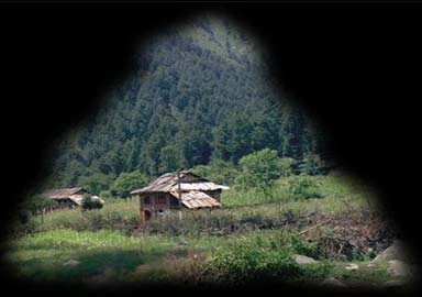
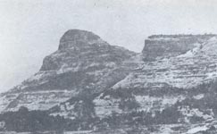
Mahuli
(762m-2501ft)
Trains
from Kalyan to Kasara go almost around this group of peaks .There are two
main formations . The fort is higher and easier to reach ,While Chanderi is
tricky and steep.The ridge from Mahuli again rises in the north to an easy
flat top called Chhota Mahuli. Mahuli fort is a popular hiking place due to
it's accessablity and it is fun in the rains, winter or on a moonlit night
. From Asangaon station ,proceed to Mahuli village (5km) The fort is on the
northwest (right), 3km away .Climb up the east face gully , reaching the saddle
at 600m . A large plateau with excellent views of Tansa lake. No water available
on the way up and only one tank in the centre .
The
Trimbakeshwar Range
The
hill forts around Trimbak are very fascinating to climb .Trimbak is a very
popular pilgrimage centre and is served by frequent buses from Nashik. One
may undertake cross-country walks to catch buses towards Kasara and Gujarat.
Brahmagiri(Trimbakeshwar)
(1295m-4248ft)
A
prominent place of pilgrimage with temple and shelter available . Reach
Trimbak from Nashik . Regular steps lead to the temple .It has a long
grassy top . Anjaneri, Harihar and Fani Donger are nearby In the pasr
the entire Trimbak range were considered as an impregnable fort.The
hill-range is almost 16km long on thr top. The real source of the Godaveri
is located at an ancient temple on it's upper plateau . A narrow passage
in the rock is cut 4 to 6 ft.with about 300 steps . In 1818 the British
conquered Trimbak and dismantled the fort. The Multani family of Karachi
rebuilt the steps and a dh
aramsala , which are now in use. |
 |
Anjaneri (1300m-4264ft.)
A
huge grass topped mountain . It has a small lake on the top . A British
Officer had built a bungalow on the top of it. It's ruins can still
be seen.Take a bus from Nashik to Trimbak . Get down 8km before Trimbak
for Anjaneri village (2km). There are excellent ruins and temples near
the village . The fort is behind the village and an easy 3km climb. Navardev pinnacle is to the west |
 |
of
the village and is easy to climb by one route . Two small pinnacles
,jutting out near the fort are called Sasu and Navri An old cave is situated on thw way to the top . Half way up , on the
plateau is dedicated to Dattatrya is situated with the Seeta Goofa(caves)
nearby. The top is still higher up and is a big plateau with a grand
view.
No
direct descent is possible to Trimbak from the fort . Towards the southern
end one can proceed to Mulegaon past Ghargad and Dangya to Wadhiware
. The road to Shirghat bifurcates at the Pegal phata on the road a little
before Trimbak . And the southeastely road bifurcates again at the Pahine
phata and passes Mahasurli (6km) and Avarli (5km) to join the Wadhiware-Ghoti
road. |
Utwad
(1238m-4062ft)
A
triangular shaped mountain sharing a common col with Basgad . On the
way from Kasara and Khodla to Mokhda , get down at Khoch or Khoch phata
. Proceed to Utwadwadi (5km)at the base . Reach the common col and climb
a gentle slope to the top from the south. |
 |
The
Northern Igatpuri Range
These
group of hills are situated rather near the Igatpuri and Ghoti railway stations
and are rather easy to climb . They offer convenient one-day outings just
after the monsoon or in winter.
Kavnai
(914m-3000ft)
An
enjoyable outing near Ghoti, a little ahead of Igatpuri . Turn from
the Nashik main road at Khambala to the left on the road leading to
the upper Vaitarna .3km ahead is vaki .A cart track leads towards the
west col of Kavnai via Beturli.From the col, traverse the base of the
massif. A narrow-chimney like formation leads to the plateau and a small
lake on the top . Village Kavnai and a big temple are on the other side
. Opposite Kavnai is the mass of Dakson (898m-2946ft) which has
a tough route to the |
 |
| top
. The sharp peak of Budhya near the Vaki village is also a good proposition
in the area. The temple of Kavnaidevi is famous in the region . The huge
temple with kunds is a popular pilgrim place. A sharp ridge falling steeply
gives a peculiar shape to this hill. From Ghoti , ahead of the Upper Vaitarna
road ,one sees the hill 6km ahead Near village Vaki ,cross a small river
and follow the steep ridge to the top. |
The
Southern Igatpuri Range
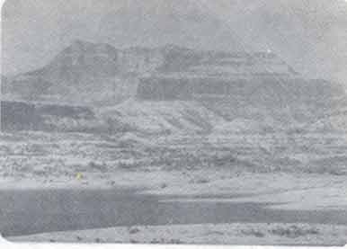
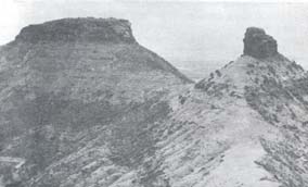
Kulang
(1470m-4822ft)
As
the train reaches the Igatpuri station ,one can see a huge massif of Mountains
towards the south . The most prominent among them is Kulang . Standing at
the edge of the ghats, it commands a fabulous view all around and the tough
climb is amply rewarded by a most fascinating sunset .Kulang offers the highest
climb from it's base to the top in the Sahyadris. From Igatpuri, walk on the
main road to the north .Buses available till Bhavli,out of the town. fromthe
first railway crossing. The route follows the Dharna river which runs down
to Pimpri village and onto Beale lake .from Kulangwadi ,one sees two mountains
in fromt.The one on the west(right) is Chhota Kulang and the one in the centre
is Kulang.Madangad and Alang are on the east(left).There are two routes to
this upper plateau .The shorter one climbs up a nala to the southwest ,between
Kulang and Chhota Kulang. Then eastwards to the base of the final rocky staircase
.The other route skirts a prominent rocky-case to climb up from the valley
at the foot of Kulang and Madangadh in the south Both the routes meet the
upper plateau .It is a very steep and an exhausting climb .A huge caves with
water cisterns nearby. No firewood.The view is the finest in the Sahaydris
.It covers Mahuli, the Kalsubai group ,and all the peaks of the Igatpuri area
upto Nane ghat and Siddhagad .Almost 50 mountain tops and places can be counted
. The final climb from it's col with Kulang will be a good challenge It does
not seem to have been climbed .If one is not proceeding to Alang ,then return
by the same route ,which is the shortest.
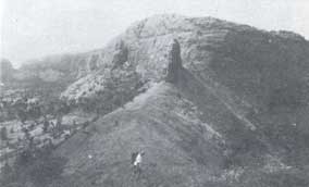
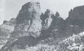
Madangad
(1466m-4842ft)
This
is a difficult fortress to reach.It's square high massif can be recognised
by a huge hole in it's western (extreme right hand) top. In fact, the
top is above the hole and standing up there, one gets a feeling of standing
on a void. Some of the steps leading up the fort have been blown up.
A steep rock face of about 20m has to be climbed to enter the fort .Proceed
fro Igatpuri to Kulangwadi as from Kulang.Turn south to climb to the
col between Alang and Madangad..A very |
 |
| narrow
and exposed track leads back tho the base of the massif. Further ahead
strps lead to a broad plateau with a huge cave and water. An excellent
view of the neighbouring Alang. It is easier to descend by rappling down.One
must be experienced and careful whilst climbing this fortress. The return
journey can be on the same route, or from Ghatghar further south by visiting
Alang. |
Kalsubai
(1646m-5400ft)
With
a height of 1646m, this is the highest peak in the western ghats of Maharashtra.It
is beautifully shaped and commands a fantastic view..The small temple of Devi
Kalsubai is legendary and receives many pilgrims..For hikers,this is a simple
mountain to climb. A bus from Igatpuri to Bhandardara halta at Bari village
, At the foot of the mountain and at a height of 792m. An easy route leads
to an upper plateau with water. The top is rocky and one can see didtant peaks
in all directions. For a change, a route from the plateau traverses the mountain
on the other side to descend the mountain .An adjoining hill(western edge)also
has a conical shape,similar to Kalsubai.It is 1580m-5185ft and is approachable
through a connecting col with Kalsubai.
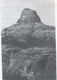
Avandh
(1319m-4329ft)
A
prominent huge rock massif,standing next to Patta fort .It has high
walls and a narrow summit .The steps to the top are blown off and, at
many places,one has to resort to rock climbing .This peak was probably
used as watch tower.Avandh is best approach from Ninavi or Girwadi,
as is Patta fort.. A track leads to the base of the rocky massif,from
where rock climbing starts . At the top, one discovers a small cave
and a fantastic view of Patta fort. |
 |
This
is based on the book 'Trek the Shyadris' By Harish.Kapadia. |